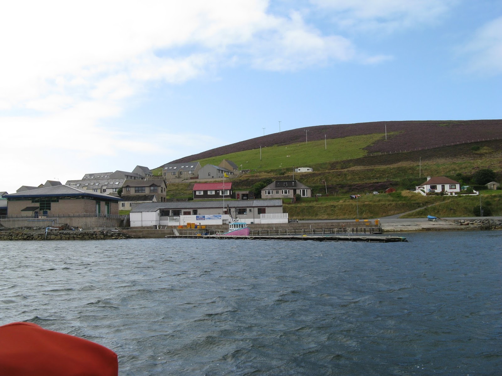
Sooth as in tooth, is the way it's pronounced round these parts. Scalloway boating club felt like home, at least the bar did so it was time to move on. The weather had been blowing for some days, up to Beaufort 8 and I reckon there was a swell running out beyond the protection of the many islands. Still it shouldn't be too bad as the forecast was for 3s - 4s on XCWeather.
The Scalloway Boating Club visitors' pontoon with the clubhouse in the background, not far to crawl after a pleasant night in the bar with the locals.
Leaving the shelter of Scalloway it was still brisk, over 20 knots on the deck. The sea state was ok but as we wended out way through the islands the seas gradually built up, and up, and up. I did consider getting the camera out to shoot a vid but Samantha had had enough and Tutak was getting stood on her rudder. I looked for a lull (yeah, right) and turned back. It was good surfing down the big waves but not for long as a mile away was an inlet called Hamna voe on the island of Trondra. We had only done 5 miles but hey it was interesting. I dropped the hook in the bay for two days listened to the waves crashing on the rocks just the other side of the promontory. The local forecast for the Shetlands was 'sea state moderate to rough, very rough in the west', very rough 4 - 6 metres which is why even I turned back.
This is the stuff that was going on the day after and still fiesty.
The lighthouse on Fugla Ness, the headland of which provided the shelter in Hamna Voe.
Even after waiting until there was virtually no wind at all the swell was still fun.
A bit further out and we came across out first ice field. Well from a distance I didn't know what to make of it. It appears to be foam, there were large patches of this as far at the naked I could see.
We passed Sumburgh head, just a couple of miles from where the helicopter went down. Not a nice place with the tide race although it actually went down in a bay rather than the open sea. Whether it was better to have ditched in the sea rather than landing on rough terrain I don't know. Either way it couldn't have been pleasant. You are taught to wait until the rotors stop before evacuating, but upside down, disorientated and about to drown..... The course set was for the northern isles of Orkney, the 'hole' was unpleasant on the return journey, throwing us around like a cat would play with mouse. I put on my buoyancy aid to give my ribs some protection. With the new seat I don't often suffer now but there are times when you need to move about. Reaching for the next handhold and finding it's disappeared and you are heading for a corner is not good. The shelter of good old Pierowall was welcome after a long and bumpy day of 70 odd miles.
The direction of the wind made the buoy in Pierowall bay uncomfortable so I shifted to anchor a few miles away on Papa Westray in Moclett bay, much nicer. I had somehow managed to time my arrival back in the Orkneys with spring tides. I had hoped to make some different passages but tides round these parts are not to be messed with. Even the ones I had done before I needed to be careful. So I retraced my course from Pierowall back to Elwick bay off Shapinsay. This meant crossing the Westray Firth again. I was able to creep up against the tide a few metres off the cliffs where there is an eddy. Eventually I had to break out and ferryglide accross the stream. The reason for this was this....
One of those new fangled tidal energy things. The pilot says to continue inside of this but I wasn't sure it was safe. Tutak was giving us 6.2 knots and we were making 1.5 - 2 knots..... backwards. I reckon that makes the tide doing 8 knots. After two hours we got into another eddy on the other side and crept back up. It is really rather disconcerting as ones senses and instruments don't seem to want to agree. I can quite see why, when things go wrong, people sometimes make bad decisions. It was starting to close in again and I was pleased that the route was familiar, especially when this loomed out of the murk.
It blew again but by the evening it had moderated some so I made a quick dash and had a blistering sail a few miles to Deer sound. There was no point in hanging around as the shop had now shut on Shapinsay, it being too rough to go ashore in the dinghy. I had an uncomfortable night because of an irritating swell and was glad to be on my way again in the morning. I had thought about Wick or back to my old favourite Whitehills but Peterhead was calling. You always have to keep your options open but the 103 miles to Peterhead straight across the Morray Firth seemed doable.
The wind was with the fast tide round the headland as I left Deer sound. No problem, oh dear, although the wind was with the tide the swell from yesterdays southeaster wasn't. I could see the white topped sawtooths in front of me.
We were soon doing over 8 knots but they were not as fearsome this time, I remember our first encounter and the laundry bill. As we got into deeper water and away from the effects of the Pentland Firth all became calmer. Naturally the wind was on the nose so we had the main and mizzen up to give us a bit of stability. Of course the visibility closed in at eleven pm and still we had a few more hours to go before the closeting comfort of the marina. Eventually at about four oclock in the morning the pierheads of Perterhead were closed and we were soon tied up in the beautifully kept marina at Peterhead. This wee sailing boat turned up the next day.
Keen to take advantage of the wind in the right direction we sadly left Perterhead bound for the Amble.
Still a bit misty, Peterhead is the most easterly point of mainland Scotland and juts out into the North Sea. This may be the reason for its frequent aquaintance with the haar or whatever they call it, fog most of them by all acounts. This was to be another direct trip which was to take us out to sea and the fickle winds inshore. Well that was the intention and it didn't work out too bad. We had winds up to 28 knots and a broad reach to boot, sometimes it was so broad I had to pole out the genoa. The tide was just right for going straight in and after 135 miles in 25 hours we tied up and took on fuel before being allocated a berth in the excellent Amble marina. I was now far enough south for the thermostat on the heater not to come on all the time. And shops, shops which opened and had things in them. Where you could by things, many many things. Where you weren't told 'the supply boat won't be here for another day you know'. Proper pubs too, ones where you didn't have to share space with the weighing scales of the postoffice or the chiller cabinet for the local meat. But I do like the Norther Isles and I must come back soon.
So, from Bressay on the east side of the islands, we were due to head north past Whalsay and through the Sound of Yell. This sound is strewn with islands which make for some funnels for the tide. Small boats have to make allowances for this or else spend their time going backwards. The day was not a bad one, bit rainy and the wind was only a few knots and not worth bothering getting wet for. Taking particular care of the many rocks on the way to Whalsay we hugged the side of Linga sound to cheat the adverse tide. There were a few large fishing boats lying in Symbister harbour, the Antares, the Zephyr, the Charisma and the Venturous, forgive me if I have the names wrong, it was a mixture of AIS and eyeball.
Fish farming is big business round these parts too.
Tutak's bridge, those things tell Samantha where to take us.
The Sullum voe oil terminal with its tanks and flare stack. They are building a new gas terminal here at the moment with about 1000 workers brought in and staying in floating hotel barges. I think there are four of them at present.
Another stunning sunset in Gluss voe, another safe and secluded anchorage.
Up at the northern entrance to the Yell sound by the Ramna Stacks.
Heading in for the Ronas voe with its distinctive red cliffs.
This is a long inlet of several miles narrowing at one point to a cable.
This is the reason sheep up here taste differently.
A close up of what they are actually doing, grazing on the seaweed.
Here we have a mussel farm, strings are held vertically between the many rows of buoys.
And this is why the beef tastes different up here, no it is actually having a drink as the burn makes its way accross the beach here, they may also graze on the beach to, I don't know for sure.
Ronas voe had to have a reason, well yes, it also has Ronas hill on its steep shore, the highest peak in the Shetland Isles. I say peak, it's only 450 metres but plenty for me. I took the dinghy to this wee bay and started the climb.
A little further up.
A bit further.
Further still and the vegetation is starting to become somewhat sparse as is the warmth from the sun. The wind is rather chilly too.
The plateau on top with its chambered cairn.
And the ubiquitous triangulation point.
The journey from Ronas voe down the west side of the islands towards the island of Papa Stour was a boisterous one. The west side is open to the Atlantic and the wind was F4 from the south, on the nose again. Our forward speed gave us 18 - 20 knots over the deck and spray was once more flying. Samantha steered and I hunkered down in the most wonderful seat. We anchored in West voe, Papa Stour for the night whilst the wind blew. The morning brought light airs and we ventured through the Sound of Papa which today was a pussy thank goodness. On eastwards along an unpromising coastline towards Scalloway, a truly wonderous vista.
This is the island of Trondra guarding its southern flank.
I have seen these vessels off Aberdeen, what they are I'm not sure, not your standard rig supply vessel, more off a marine fire and rescue service perhaps.
Yoal racing is abundant round about with each habitation having a go against the competition.
It has been blowing for a couple of days now. There is also the Viking challenge taking place, a 4 day rod fishing competition off small boats. These birds have arrived for the occasion as there are lots of guts at the end of the weigh in.
The strong (5-6 gusting 7-8) wind made them virtually stationary in mid air and fascinating to watch, they even seem to use their webbed feet as flaps for extra lift.
I was on the windward side of the pontoon, and stayed there to allow some of the smaller boats to have shelter on the leeward side. That was until the competition ended and most of them left and then I moved to the more comfortable side myself, it was a struggle mind and some kind fellow braved the undulating pontoon to get wet and help, thanks.
There is an anchorage on Bressay, the island opposite Lerwick which protects it from the east, which is almost landlocked by an islet in the narrow entrance to the bay. Aith voe is its name and it lies on the north east side of the island. Why this place in particular, well apart from being a nice sheltered spot for the night, it also has, close by, a WWI gun on the top of a hill. Score hill overlooks the north-eastern approaches to the safe anchorage of Lerwick, but quite how they managed to get this gun up here I don't know.
The climb to the top, according to the OS map, was 65 metres. The only thing is I forgot to take the map with me and I climbed the wrong hill first off, having to traverse a geo between the two hills, bugger. You can see the gun centre top of the mound.
And here it is, breech missing, but still on its mount and surrounded by a low concrete parapet.
I measured the bore, just under six inches. With the rust it may have been a six inch gun I don't know. It appeared to have two large (recoil) springs mounted underneath.
These two alcoves were either side of the access from the path to the magazine.
The entrance to the magazine, a winding path and lower than the gun platform.
On the way down I stopped off at a quarry that was used, amongst other things, to supply the flag stones for the streets of Lerwick.
Tutak, anchored in the distance over the spoil heaps.
Maybe this ewe is pondering the choice between the abattoir or an earlier demise at her own hoof.
The last section was a bit boggy being the run off from the lake above. In the more sedentary streams the dreaded midges were congregating so I made a hasty retreat to the safety of the boat.
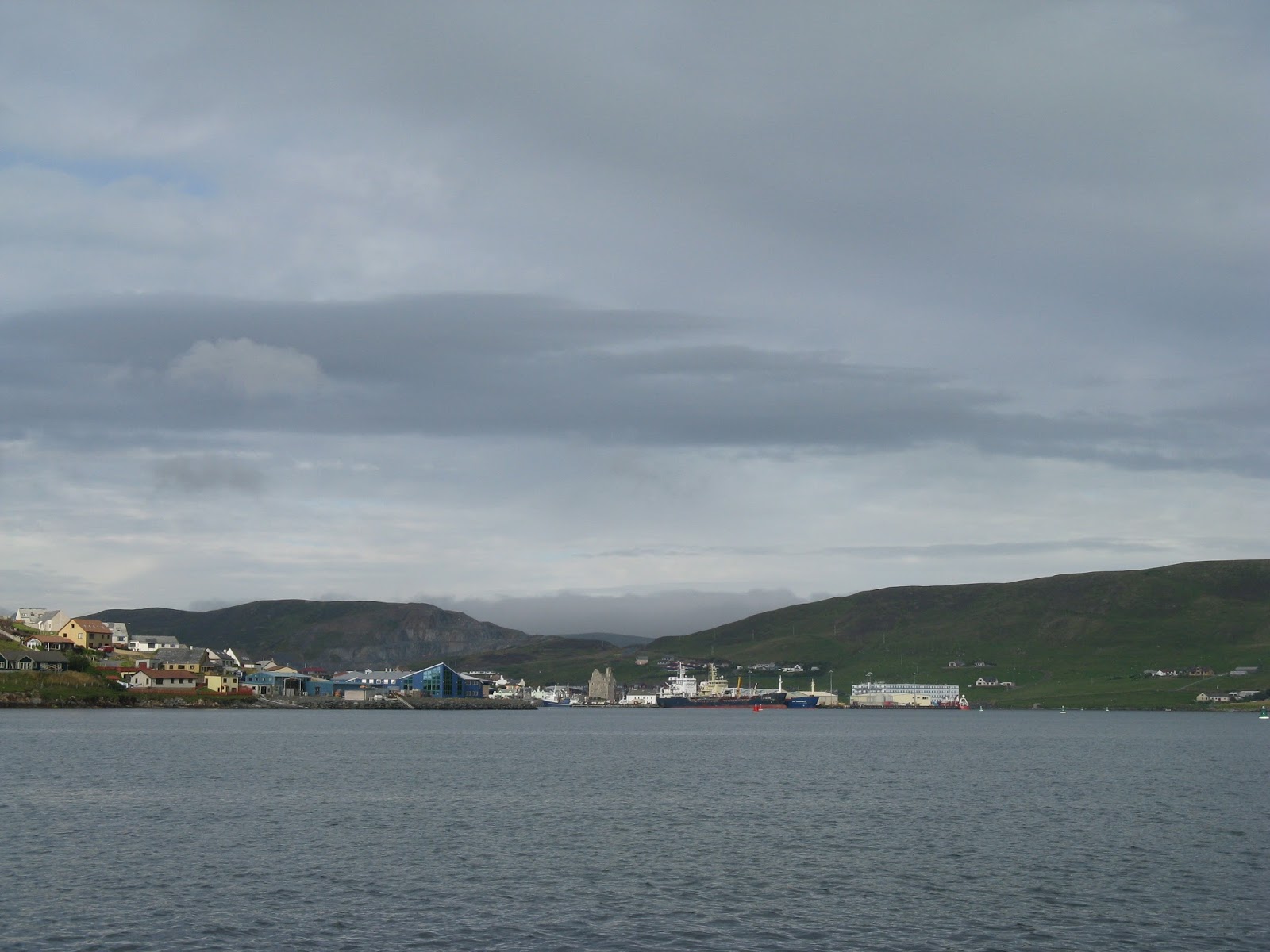
It's nice to visit familiar haunts. No stress as you know what to do and where to go. Always finding new places actually means doing a lot of work especially if the pilot books don't list where you want to go. 'Anchor in the east of the bay' the book might say. But I want to anchor in the west to get out of this large wind. Why can't I anchor in the west, well get in the dinghy with the portable gps and lead-line and find out. This means dropping the hook in the east where it's poppley and getting wet whilst making sure that there are no rocks in the way. I digress, Lerwick is a wonderful place and after stuffing myself with a most wonderful Chinese take out, I set about finding someone who could fix my alternator. Maybe I wasn't clear but everyone kept telling me to go to the marine engineering places. I knew those from the last trip so I went to Thule Craft and explained. She got on the phone and called Campbell, who said Shaun was the man, up by the carpet shed near the incinerator. Out comes the laptop and a map of Lerwick comes up with Shaun of Autolec, off comes the alternator and out comes the bike and off we set to see Shaun. Shaun has a large machine that can do magic with alternators, dynamos, starters, distributor caps, leads, everything you would need to do to machines of the last century and he knew how to use it. Best of all he could fix it with stuff he had in stock (also from the last century probably). He also checked my spare alternator too and diagnosed the problem with that. Now I have loads of electricity to keep the fridge running and cold for the beer.
Walther came to visit. You can tell it is a German ship, the crest is a give-away, and somehow the courtesy flag is the Union Flag and not the Red Ensign, unless the Treaty of Versailles has made other arrangements?
I left Lerwick at the start of the Boat Clubs annual regatta, sunshine and not much in the way of wind.
Some parts of the waterfront are naturally quite commercial but this is the scene as you exit to the south.
As it was a calmish day I was keen to see if I could find the "Orkneyman's Cave", full of mineral colours and stalactites and accessible by dinghy. There are supposed to be mooring rings in the cliff face as it is steep too around there. I couldn't see them and it wasn't as calm as I thought it was going to be anyway! I think I identified the cave you can just see the start of the colouring inside. It opens up and is rather large once you get in. A bit further along are the "giant's legs" or something.
Just round the headland with its reef, is Noss Head, home of gannet city.
There is an even bigger cave here, one into which even Tutak might fit. Being on the lee side it was also a lot more comfortable. I managed to get quite close but bottled it when I felt "suck" when one is drawn, against ones will, inexorably into a black hole, nah Blad.