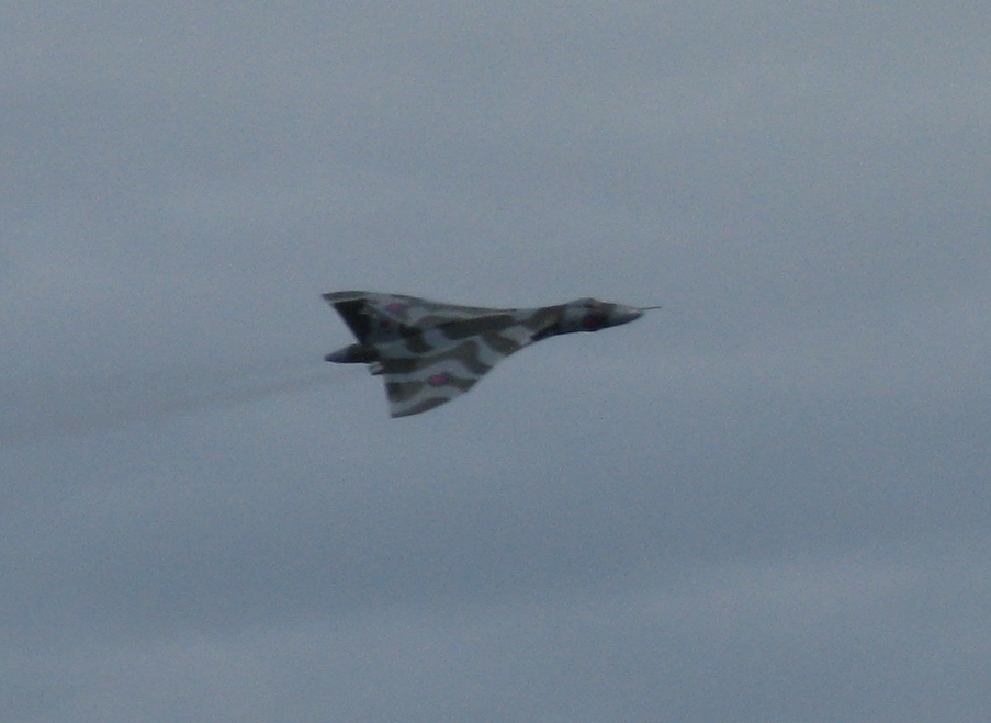
We decided to have 24 hours out and take in the Clacton air show. There was a reason for this as we had already had a very good time at the Sunderland air show and this was going to be much of the same. The Avro Vulcan, it is the last flying season for the aircraft and although it has been resurrected before I reckon this will be the last time.
It was a force 5 - 6 day and the anchorage off the beach was a bit bouncy but I managed to get the odd picture or two, magic.
Above is what it looks like flying and some good commentary on it too.
Below we have some pics, the quality of which depended on how well I was hanging on and how well the image stabilisation of the Cannon coped with the swell.
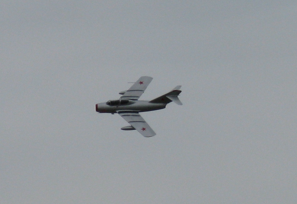
Here we have a MiG-15, Sally B the Flying Fortress, the Big V, and the Typhoon, oh, and the odd Thames Barge thrown. I missed the Chinook as I was so impressed with its antics. They must have learnt those from dodging missiles in Afghanistan 'cause surely they wouldn't learn it a fly school?
We didn't have to wait long for a window. Theoretically there was a 36hr slot before the next low romped in and battered us. I am not a piece of fish and this year have had my feathers ruffled. To top it all they reckon it was Scotland's worst summer for four decades: just my luck eh. Still, on the last visits the roads were melting.
The alarm was set for 04:30 (oh what joy) and we set about releasing ourselves from the "tractor beam" that is the Humber. Careful timing of the tides meant that we could take the tide all the way to Norfolk's corner and perhaps wait awhile in the roads of Gt Yarmouth, we'll see. Light winds meant the Bukh was called upon to keep up a descent average, or else we would be off the North of Norfolk forever.
The Donna Nook range was not active until sensible hours so we were able to knock the corner off and lay a course for the Inner Dowsing and thence for the North Docking for the Race channel. Eyes were kept on the rear view mirror as ships tend to creep up on you round these parts as we are using their routes.
The main, mizzen, genoa and tide were all adding to a respectable rate if knots, peaking at 7.8 off the East Sheringham Light Buoy. The corner saw us with the tide foul and we were down to 3.7 off the entrance to Gt Yarmouth at 21:00, this far south it was also getting dark!
A shout went out for a disabled motor yacht, the "Blue Waters". It was a coded vessel out of Lowestoft and was out to a tanker offshore. I was too far away for quick assistance but the weather was fine anyway. The Lowestoft lifeboat was tasked to tow the stricken vessel in and I kept an eye on what was going on via the AIS. Looking at our courses and speeds I reckoned that we were going to meet in the Holm Channel. It is not wide and the sands on either side can be a bit of a menace and one can be seduced into taking short cuts but it's not a good idea, even for me.
Anyway to make a short story long, I tried calling the lifeboat on 67 which he was using as a casualty working channel. I tried on 16 but he was not going to answer me and by this time we were head on with him towing on my side of the channel in the dark. We were getting close and I reckon he was going to turn across my bows with the tow towards Lowestoft harbour. I called again on 16 and said "this is the vessel directly in front of you", that got his attention and I offered him "green to green" which he (gratefully) accepted. I do believe he hadn't seen me as he was concentrating on his tow and crew.
I had decided it wasn't worth stopping for the tide and by the time we had reached the Dunwich Band we had the tide with us again and belted past Aldeburgh and the Whiting Bank at 7.5 knots still under full sail and motor. The wind had by now crept round to be on the nose, what else?
The Beach End in Harwich harbour was rounded at 05:00 and by 05:35 we were anchored in one of my favourite places under the old HMS Ganges. Twenty four hours took us 140 of our nautical miles, and average of about 5.8 knots. I wouldn't mind doing that all the time, if only. I had a few hours sleep and took the last of the ebb out of Harwich and headed south for the Naze under main and genoa with the Bukh giving a hand as the wind was light and ahead. Off Jaywick and a nice tide with us we were able to turn off the old knocker and trickle up the Blackwater. We dropped the main and tidied things up at the Nass Beacon and used the genoa to ghost up the creeks and gutways back to our home mud berth. Sixty nine days saw us travel 1527NM, an average of 22 miles a day. Average for us old folk and I am more than happy with that. Yes it would have been nice to get back to Shetland and Cape Wrath and visit my mate's new house on Raasay but, God willing, there's always next year.
The forecast was for low to follow low and I just didn't fancy any more wind on the nose, especially crossing over to Norfolk. It's quite exposed out there with few places to run to so I decided to head west and explore the Humber a bit. So once more we hauled in the chain and brought the sweet 16 big Delta into the self launching roller and broke out the genoa and took the tide up river. We crossed the line from channel 14 to 12 so we could listen to Humber VTS (vessel traffic service) and the ship movements. Listening in is important as there is a huge volume of shipping in the Humber. With the brisk easterly we headed to the north bank to avoid the congested areas of Grimsby and Immingham on the south side. Heading over to Hawkins Point and past the Papa six buoy, we had to cross the deep water channel which is kept thus by dredging, such is the movement of silt and sand in this part of the world. Even with up to date charts the shoal areas were nothing like the paper version and a sharp eye has to be used to watch the water ahead. The wind had increased to 20 knots over the deck by now and we took a roll or two in the genoa to slow us down a bit as the tide was hustling us along by now. We had to recross the shipping channels to reach our anchorage and to aid navigation we took in the sail and started the Bukh. We had to stem the tide to wait for a ship to pass and it took all of the twenty horses just to stem the shifting tide. Ferry gliding the rest of the way across the channel we made the channel that led to Skitter Haven, our chosen anchorage.
We had a bit of a kerfuffle dropping the anchor. It was less of a controlled operation than one would have liked. In the interest of fitness I have taken to handling the chain without the aid of the windlass, letting go and hauling in by hand only. So as I headed up into the tide in the narrow channel made by the large mud island off the haven I went forward to let go. The big Delta went over the bow and the chain rattled out through my hands. Twenty metres, thirty metres, that'll do, close the fist and take a turn round the bollard. Yeah, right, forty metres, how are we going to stop this? The boat was falling back hard on the tide and I could not hold it with just my hands. I reckoned if I could get the chain out faster than the boat wanted it then I had a chance. Fifty metres, only ten left and the bitter end, a turn is got and surged and slowed and a wrap on the gypsy, got it......... I had buoyed the anchor in case of a trashy bottom but not with the intention of recovering a lost anchor. Lesson learnt, use the windlass to let the chain out in a tide way. The log was registering 3.5 knots when we eventually sorted things out. No way could I hold Tutak doing that speed. Next morning my arms felt like they had been torn off my torso! The 'out of the tide channel' no longer existed. The protecting shoal had disappeared and we had tide, a lot of tide even though it was the inside of the bend. Eight knots on the other side and three and a half where I was.
A bit later the ferry left Hull bound for goodness knows where, maybe the name gives a clue - The Pride of Rotterdam.
On the south side to the east of us is the Ro-Ro terminal, with Immingham in the distance.
We had a magical sunset again.
For the next leg up river we didn't need the whole of the tide to make our destination. Only a couple of hours was needed to make South Ferriby, a mere baker's dozen miles down tide. My only worry was recovering the anchor with the tide running full chat. I gave us an extra hour to allow for eventualities and then some to retrieve the fifty odd metres of chain and the Big Delta. I did try using the windlass to recover the chain but it was hopeless. I used the engine to power ahead and then trot forward to try and get a few metres of chain aboard before we fell back again, no good. I set the engine on half throttle and went forward, but we just veered off with the flow against us. Eventually I set the revs to 3/4 and engaged the auto pilot to try and stop the swinging. It worked after a fashion and we managed to get the chain marker to twenty. We had to have more revs to break out the anchor and that done the tide took us away up river under no control until the anchor was catted and we could get back to the wheelhouse.
We shot past Hull only managing to glimpse this building.
Closer inspection gives us this.
Looks pretty futuristic does "The Deep", Hull's huge aquarium. The wind had veered southwest by now and the bend in the river means it is now on the nose. What joy! Our forward speed with the tide means we have 20 odd knots of wind over spring tide. The water in the Skitter Channel off Hull had been whipped, like a meringue, into frothy peaks of white water and Tutak got all excited and started to rear up on her transom, oh sweet Tutak. They do say this bit of water can be dangerous to small craft in this situation. I'm glad I left a bit of time in hand because this section took some negotiation. We had to head for the windward bank and try and get some shelter before we could make our way upstream for the distant bridge.
The relentless tide gave us no rest bite and the bridge was upon us in an instant.
Now when one nears a bridge for the first time one likes to check that one did get the clearance right.
Just in case, you understand, just in case. Not that I could have done much against this tide anyway. Under we go with just a gnats whisker of a gap......
I reckon we had about 19 metres above the top of the mast, just about scraped under then, phew. Once you get on the other side of the bridge things get tricky. Both chartplotters go to white screen. There are no charts for this section of the river unless one gets them from Associated British Ports. The channel changes so often that surveys are constant to check the deep bits. I was having problems with Internet access but I had managed to download the latest charts onto my phone but the screen size was abysmal, resolution was good but not really up to navigation. So the previous evening I was checking on the progress of vessels upriver with the AIS. That's the automatic identification system, it gives the ship's position, course, speed, Captain's inside leg measurement.... Well, a lot of information about where and what the ship is doing. So I tracked three ships going up the river and marked their positions every quarter of a mile on the chartplotter. This gave me a track to follow on the white screen which was the deep water channel. I thought that was pretty clever, even though I do say it myself. The basic channel is marked by the ubiquitous Humber Light Floats.
These mark the channel but care must be taken to follow the curve of the channel and not necessarily take the straight line between them. Always assuming you know where the next one is anyway.
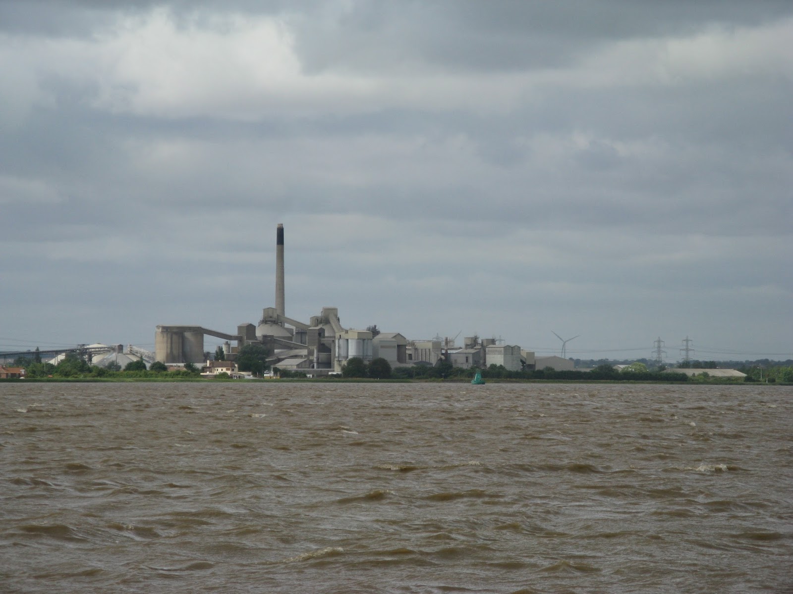
Our next landmark was to be the chimney of the cement works which marks the locked entrance to the river Ancholme via the South Ferriby Sluice. I had already 'phoned the sluice keeper to check availability and the times of the openings the night before. I tried a couple of times to raise him on VHF 74 but with no success. He actually rang me on the mobile to check if I was going to make it. One has to get things ready for locking and it's not worth the fuss for nothing. The chimney came into view. What I hadn't realised was the size of the works, they are massive. It's not just the chimney that is 'conspicuous'!
As one gets closer the pub adjacent to the lock becomes clearly visible.
I gill about waiting for the levels to drop a little. The tide was too high to allow for high water locking. It hung around for a bit longer than expected but the time was spent in the finer points of Tutak behaving in wind and tide. The bow blows off downwind and she tends to settle side on, with the bow just a bit further off the wind. We tried to match the drift with the incoming tide and did quite well and managed three boards before being called into the lock. With the gates shut behind us and the Guernsey ensign showing proudly we sighed a relief to be free from the mighty tides of the Humber for a bit.
Check out the colour of that water. It's pure mud I swear. I got chatting to the man in the orange hi-vis. He was doing some repairs to the sluice. Asking where from and where to I mentioned the Blackwater. He replied that he was responsible for the gas axing of the Baffle Wall of Bradwell's nuclear power station that was. Small world.
The keeper of the sluice commented on Tutak and what a nice boat she was. I felt a bit of preening going on beneath my feet, Tutak understands you know. He also told me there was a bit of silting but I should be able to push through. Hmmmm.
We did make it and tied up in a rather pleasant spot. Neatly kept and clean, especially the facilities.
All the silt ends up at this end of the river for reasons that may be clear. It doesn't get used much for access to the Humber anymore and so it doesn't get washed out either. A small 360 excavator digs the worst out but even still I managed to block my water intake on the way in and out. If you are expecting it then it is not a problem, inconvenient but not a problem. You can see the sluice and the build up of weed in this shot.
The barge is run as a charity, taking folk down and up the river for shekels to fund the upkeep. There aren't many left of these Humber craft. Tutak is a bit further upstream in water only slightly deeper. The structure across the river is a conveyor for the (chalk?) cement works.
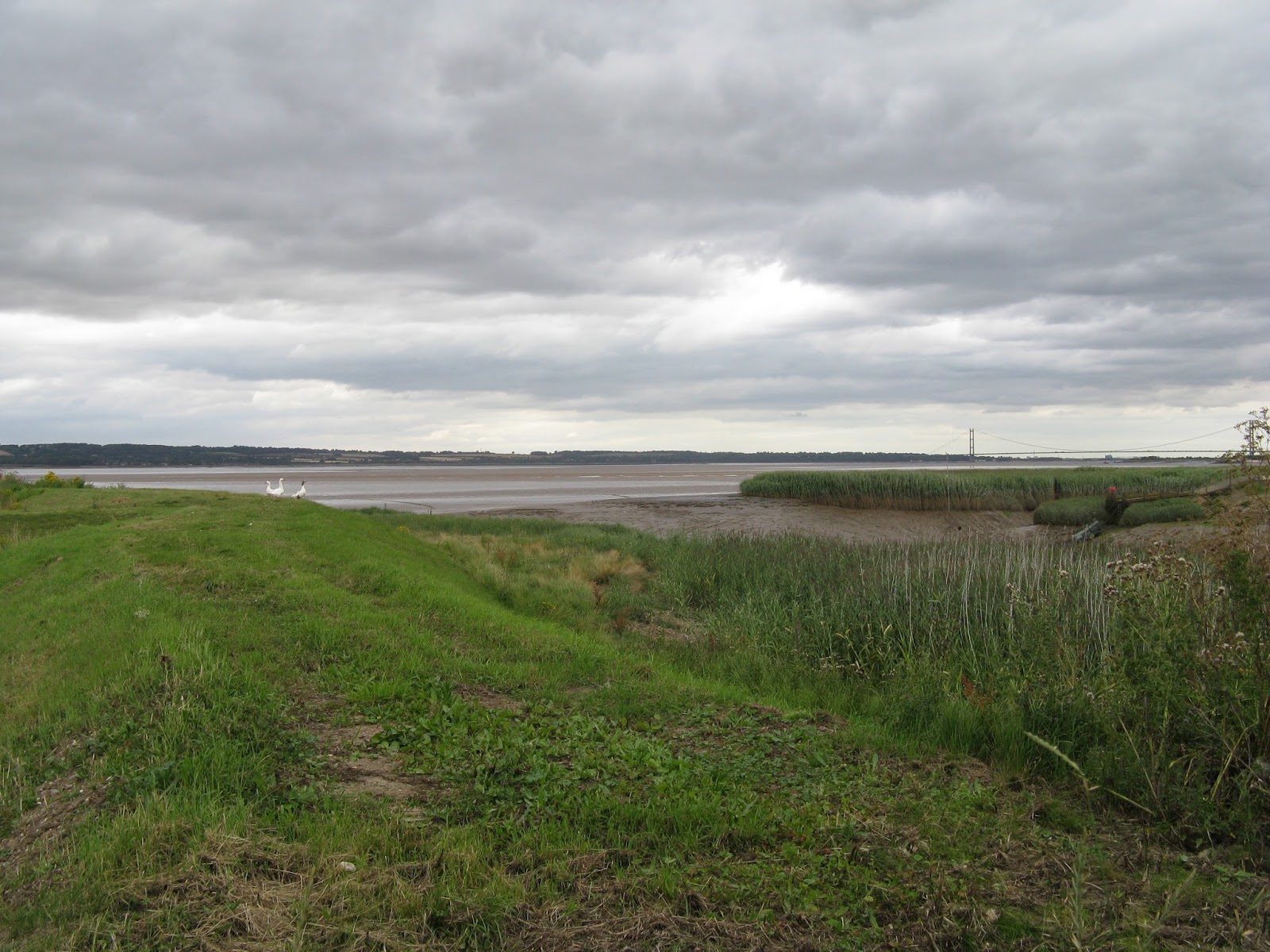
I went to check on the entrance at low water.
I wanted to be sure of the channel as I would be leaving on half tide when much of the mud would be only just covered.
As I climbed the fence to check on the distant mud the guardians of the secret of the channel barred my way.
Still, I got the gist of it and made a sketch to, hopefully, guide me to deeper waters. We had another beautiful sunset, not marred by the gargantuan factory only metres away.
I promised I wouldn't say but the shellfish lady gave me some fresh baked ginger flapjack, lipsmackin, thanks. Our sojourn in the Ancholme lasted but a day or three. I could easily have spent a week here such was the niceness of the spot, despite the vastness of the works next door. The aim was to reach the river of my birth, the Trent, flowing through Nottingham's fair city to its confluence with the Humber. Alan, the long serving keeper of the lock, with whom wonderful conversations can be had in the control room by the busy road, equalled the levels and waved goodbye or adieu, for it is my intention to return. Once we had unblocked the filter and found the deep water, we headed upstream, following the windings of the channel. We were following in a ship's wake and making over 9 knots such is the rate of flow. We made Trent Falls, the area where the Humber meets the Yorkshire Ouse and the Trent. It was here, just into the Trent that I was going to anchor. I might be OK for a ship but there was no way Tutak was going to stay here. The secret is once more in the name. Niagara Falls has a similar name, not the first bit, I totally agree, but that's not the bit we need to concentrate on here. The water was undulating with the spring tide making its way up and the freshwater making its way down. There was obviously a bit of a tussle going on and I was not prepared to hang around to find out who was going to win. Passing through was no problem but it would have given me the heebie-jeebgies to stay there for the night, that much I will tell you. We hoofed it to the inside of the bend to enable us to make against the tide and crossed the Apex. The term for the bit where the three rivers adjoin and marked by this sectored leading light.
The currents can be seen better but not understood in this one.
I'm not sure that I like rivers all that much, they scare me, truth be told, well, big ones that do this do! The sun had come out and it was time for the sails to come out in sympathy too. We snook to the north side of the river with the intention now of taking the ebb back to Haile Sand at the mouth of the big river. We took the channel between the mainland and Whitton Island, meeting several yachts racing up and down tide out of Brough, home of the Humber Yawl club. How many of them have Humber Yawls now I don't know, but not many probably. The Whitton channel leads past the entrance to the Market Weighton Canal and the Weighton Lock. We had a looksee but there is a fixed bridge that is no good for Tutak.
Well worth a look with a lowered mast or no mast at all I think. And this is Brough Haven, home of the HYC.
Adjacent is the works of BAE Systems where I think they build the Hawk trainer, amongst other things probably. Brough aerodrome played its part in WWII.
It became a matter of serious pilotage from there on as we had decided to take the unsurveyed northern route past Oyster Ness and into the Redcliff Channel. The shoal on the outer edge of this channel was nearly as wide as the river and particularly troublesome and it felt like we were having to venture off the confines of the chart to get round it. Make it we did, just, with as little as 0.1 of a metre under the keel and the tide away too. We rejoined the main channel just before the bridge whereupon we kept to the south side and passed all the jetties and dockworks of the Immingham side, past the entrance to Grimsby and out into the river to pass the sands of Clee Ness. Even here we were able to make our way at low water to where water should not have been. As tight as we could, we dropped the hook off the gently shelving beach of Cleethorpes to await the break in the weather that may allow us a fair crossing to Norfolk.
I would just like to welcome all the folk from the US of A who read this blog. Greetings to you all, you make up about 50% and being as there are so many of you I would welcome any comments on how it might be better for you. Maybe I could use some different terms or describe things better? Anyways a big hello.